

Unveiling the World from Above: The Power of 2D Mapping with Drone Surveys
Drones have revolutionized numerous industries, and one of the most impactful applications is in the field of mapping and surveying. 2D mapping with drones offers a fast, accurate, and cost-effective way to capture detailed aerial imagery and transform it into valuable spatial data. This technology is changing how we understand and interact with our world, providing insights that were previously difficult or impossible to obtain.
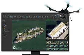
At its core, 2D drone mapping involves using Unmanned Aerial Vehicles (UAVs) equipped with high-resolution cameras to capture overlapping aerial photographs of a specific area. This data is then processed using specialized software to create orthomosaic maps. These maps are geometrically corrected images, meaning they are scaled and oriented to accurately represent the Earth's surface. Unlike standard aerial photos, orthomosaics can be used to measure true distances, areas, and angles, making them essential tools for various applications.
The benefits of 2D drone mapping are numerous:
Efficiency and Speed: Drones can cover large areas much faster than traditional surveying methods, significantly reducing project timelines.
Cost-Effectiveness: Drone surveys often require less manpower and equipment compared to conventional methods, leading to substantial cost savings.
Accuracy and Detail: High-resolution cameras on drones capture incredibly detailed imagery, allowing for the creation of maps with centimeter-level accuracy.
Accessibility: Drones can access difficult or dangerous terrains, making it possible to map areas that would be unsafe or impossible to survey on foot.
Versatility: 2D drone mapping has applications across a wide range of industries.
Applications of 2D Drone Mapping:
Construction and Infrastructure: Drones are used to monitor construction progress, create topographic maps for planning, and inspect infrastructure like bridges and roads.
Agriculture: Drone imagery helps farmers assess crop health, optimize irrigation, and monitor field conditions.
Environmental Monitoring: Drones can be used to track changes in landscapes, monitor deforestation, and assess the impact of natural disasters.
Land Management: 2D maps are essential for land surveying, urban planning, and managing property boundaries.
Mining and Quarrying: Drones help with stockpile management, volume calculations, and monitoring site safety.
Emergency Response: Drones provide critical aerial views of disaster areas, aiding in rescue efforts and damage assessment.