

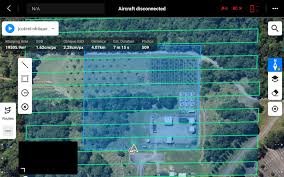
Beyond the Bird's-Eye View: Unlocking Detail with the Drone Oblique Route Function
The Drone Smart Oblique Route Function is an advanced automated flight planning feature that enables drones to capture high-resolution imagery from multiple angles (oblique views) in addition to standard top-down shots. This intelligent capability is crucial for generating highly detailed and accurate 3D models of complex structures, urban environments, and vertical assets. By optimizing flight paths and automating camera control, it significantly enhances data quality, increases efficiency, and expands the range of detailed visual inspections and mapping applications for various industries.
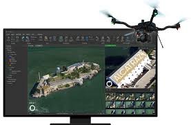
Unveiling the World from Above: The Power of 2D Mapping with Drone Surveys
2D mapping with drones utilizes UAVs to capture high-resolution aerial images, which are then processed into geometrically accurate orthomosaic maps. This technology offers significant advantages over traditional surveying methods, including increased efficiency, cost-effectiveness, accuracy, and accessibility. With applications spanning construction, agriculture, environmental monitoring, and more, 2D drone mapping provides valuable spatial data for a wide range of industries.
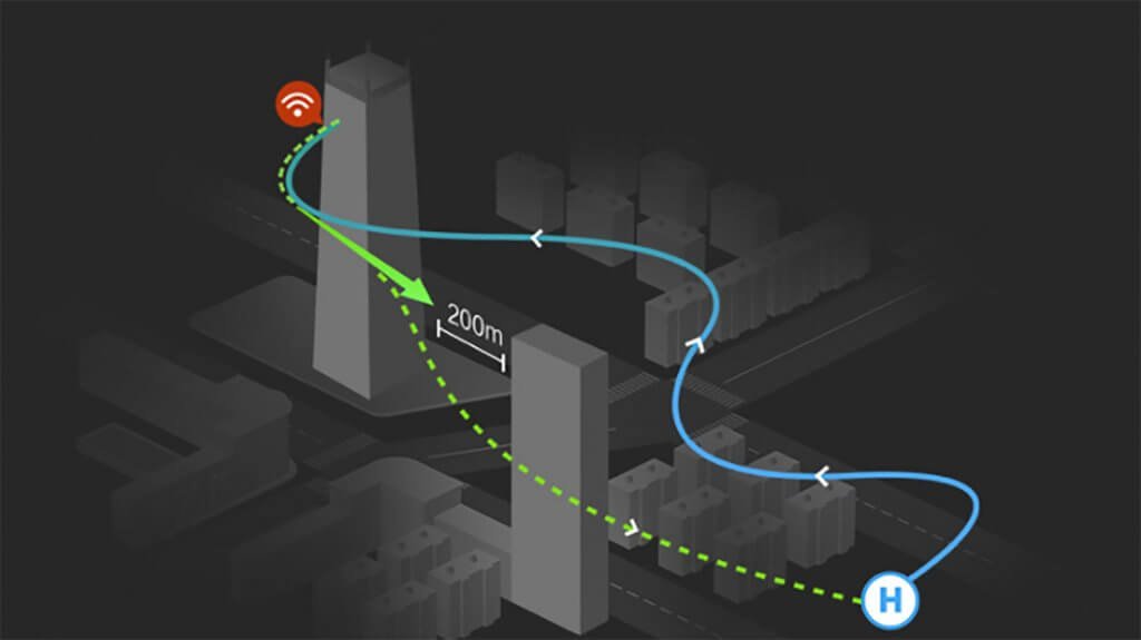
The Crucial Role of Automatic Return-to-Home in Safe Drone Flights
The Automatic Return-to-Home (RTH) function is a vital safety feature in drones, enabling autonomous flight back to the take-off point in scenarios like signal loss, low battery, or pilot disorientation. This crucial mechanism acts as a safety net, preventing potential crashes or flyaways by ensuring the drone can return to a known location without manual control. Understanding and utilizing the RTH feature is essential for safe and responsible drone operation, providing pilots with added security and peace of mind during their aerial missions.

DRONE Roof Inspection
Drone technology is revolutionizing roof inspections by offering a safer, faster, and more accurate alternative to traditional manual assessments. By capturing high-resolution imagery and often thermal data, drones can quickly identify potential issues like damaged tiles, leaks, and insulation problems across the entire roof surface. This detailed visual information leads to more comprehensive reports, cost-effective maintenance decisions, and improved safety by eliminating the need for physical roof access. Ultimately, drone roof inspections provide a clearer, more efficient, and safer way to understand and maintain the health of any building's roof.

What is a Drone?
Drones, also known as unmanned aerial vehicles (UAVs), are aircraft that operate without a human pilot onboard.