

Construction & Civil Engineering
Capture Progress. Feed the Plan. Cut the Guesswork.
From earthworks to final handover, accurate site data fuels smarter decisions. We deliver visual records that plug straight into your project ecosystem—supporting AutoCAD layouts, BIM collaboration, clash detection, site verification, and as-built documentation.
Designed to reduce site visits and enhance coordination across teams, our outputs keep projects moving forward, with clarity from start to finish.
What if your site updates worked as hard as your engineers?
DOLLHOUSE Walkthrough
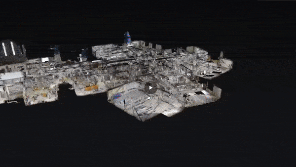
Description:
The 3D Dollhouse view allows anyone to virtually explore your building in a realistic, interactive format. It’s like walking through the facility without being there—great for teams working remotely or for clients who want to see a space before visiting.
It’s especially useful for walkthroughs of complex interiors like warehouses, labs, or retail spaces. Teams can navigate floorplans, take measurements, and plan changes—all with a click. It’s a smart way to document interiors and keep a digital record of the space.
Benefits:
✓ CAD & BIM Integration
✓ User-Controlled Navigation
✓ Design & Floor Plan integration
✓ Integrated Measurement Tools
✓ Remote Access and Flexibility
✓ Resolve Commercial disputes
2d map

Description:
A 2D map offers a high-resolution, birds-eye view of your entire facility or property. This visual layer gives a clear understanding of how your site is laid out, including buildings, equipment zones, and access roads. It helps decision-makers and on-site teams align on logistics, workflows, and safety planning.
Having a current map is especially useful for updating outdated site plans, tracking changes, and monitoring asset locations over time. It can be used in meetings, sent to contractors, or embedded into facility management platforms, giving everyone a shared, visual reference.
Benefits:
✓ Stockpile volumes
✓ Cut/fill tracking
✓ Material planning
✓ No manual checks
✓ Yard optimization
✓ Volume change logs
3D Model


Description:
3D model gives a precise digital replica of the real-world site. This helps engineers, planners, and stakeholders understand terrain, structures, and current progress without needing to visit the site. It reduces misunderstandings and supports better planning.
Using drones to create 3D models eliminates the need for manual site surveys in dangerous or hard-to-reach areas. Data can be collected quickly, reducing field time and improving safety for workers while keeping operations efficient.
The 3D model can be used for measurements, clash checks, and progress tracking. This supports smarter decision-making by giving teams a clear, up-to-date visual of the site, leading to reduced errors, delays, and costs.
Benefits:
✓ Area Mapping
✓ Remote Access & Easy Navigation
✓ Measurement Capabilities
✓ 3D Model
✓ Design integration
✓ Expansion planning
✓ Clash detection
Volumetric Analysis

Description:
Drones can measure stockpiles, cut/fill areas, and excavation volumes accurately in a fraction of the time compared to traditional methods. This provides reliable data for planning, billing, and resource management.
Volumetric surveys by drone reduce the need for people to physically walk on unstable or hazardous terrain. Hard-to-reach areas can be surveyed from above, making the process much safer and more efficient.
Regular drone surveys help track material movement and project progress over time. Teams can compare volume changes across different dates, supporting better decisions and tighter control over costs.
Benefits:
✓ User-Controlled Navigation
✓ Remote Access & Collaboration
✓ Measurement Capabilities
✓ Design integration
✓ Updated site records
360 Virtual Walkthrough
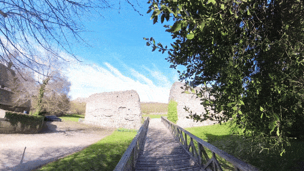
Description:
A virtual walkthrough using 360° imagery lets users look around and “walk through” a from any browser. It’s a quick, cost-effective way to capture interiors for documentation, stakeholder updates, or compliance checks.
These walkthroughs are useful for weekly progress checks, vendor briefings, or equipment tracking inside buildings. It provides a visual history that can be reviewed anytime, reducing site visits and simplifying project communication.
Benefits:
✓ Fast interior capture
✓ Visual status audit
✓ Minimal disruption
✓ Easy sharing
✓ Remote training
Drone Inspections

Description:
Drone inspections are perfect for surveying rooftops, facades, and tall structures without needing lifts or physical access. High-resolution imagery allows for clear identification of defects, water damage, or other maintenance issues from a safe distance.
By reducing the time and risk involved in manual inspections, your maintenance cycles become more efficient and proactive. It’s an excellent tool for facility managers, insurers, or construction supervisors who need reliable visuals without interrupting operations.
Benefits:
✓ Safer Inspections
✓ Cost-Effective Solution
✓ Detailed Visual Data
✓ No Scaffolding Needed
✓ High-resolution pictures & videos
3D As-Built

Description:
Smart 3D As-Built capture produces centimeter-accurate models, ideal for checking alignment, elevations, and dimensions. It confirms if built work matches design, unlike standard 3D models which lack this precision.
It captures dense, high-resolution data over large or complex sites, with minimal ground work. Hard-to-reach or live areas are covered safely and quickly, improving both speed and safety.
The model becomes a reliable digital record for tracking progress, quality checks, and client reporting. It helps detect issues early, supports smooth handover, and builds trust with clear, accurate documentation.
Benefits:
✓ Centimeter-accurate site data
✓ Verify build to design
✓ Fine-detail structure capture
✓ Precision measurements for QA
✓ Detect deviations early
✓ Trusted client documentation
Aerial Photo & Video
Description:
Aerial photos and videos offer a compelling way to showcase your facility or project. From highlighting scale and layout to capturing dynamic movement, these visuals are perfect for presentations, reports, or even digital marketing.
They also serve as a record of changes over time. Whether it's construction progress, completed upgrades, or site activity, aerial media adds clarity and polish that ground-based photography can't match. It's a powerful visual asset for any professional setting.
Benefits:
✓ High-end visuals
✓ Before/after views
✓ Site Layout Clarity
✓ Safer Inspection
✓ Training support
Follow up package

Empower your project management with our scheduled drone progress updates and 360° virtual walkthrough service. This service delivers high-resolution aerial imagery at pre-arranged intervals, providing the visual information needed for accurate progress assessment, improved project control, and confident decision-making.
Perfect for construction sites, renovations, and large-scale developments where consistent visual documentation is critical.
Contact us
Interested in working together? Fill out some info and we will be in touch shortly. We can’t wait to hear from you!